Kamera na poletištu, pogled u živo
Weather Station at Takeoff
Leotar - Gljiva
Basic Information
Trebinje is a tourist city with a significant number of tandem flights taking off from the Gljiva launch site. The launch is located just below the Austro-Hungarian fort of the same name. Due to its spaciousness, favorable slope, and grassy surface, it is considered a relatively easy paragliding launch site.
Important Notices
Consult local pilots and monitor changing weather conditions. Wind at the launch site and in the surrounding valley can often become unsuitable for flying due to its strength and frequent changes in direction throughout the day.
Before takeoff, it is necessary to contact the local paragliding club Aero klub Trebinje by phone +387 65 545 070
Airspace
Prior notification of air activities to air traffic control is required. BHANSA in Banjaluka.
Location and Access
Do poletišta je dostup moguć putničkim automobilom. Preporučuje se korištenje gradskog taksija – vozači uglavnom poznaju relaciju i često voze izletnike i paraglajderiste.
Elevation
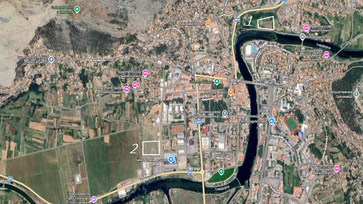
The launch site is located on the eastern ridge at an altitude of approximately 990 m above sea level. Landing is carried out at the official landing field – a grassy area west of the Retirement Home, near the Trebišnjica River. Landing is also possible at the Fire Station landing area, but for this site you must have sufficient altitude to cross the city. Trebinje is situated at an elevation of around 275 m above sea level, allowing for flights with a height difference of more than 700 m.
Launch and Landing Sites on the Map
- Takeoff: 42.7351, 18.3739
- Landing 1: 42.715887, 18.350184
- Landing 2: 42.707606, 18.337355