Takeoff Kruškovac
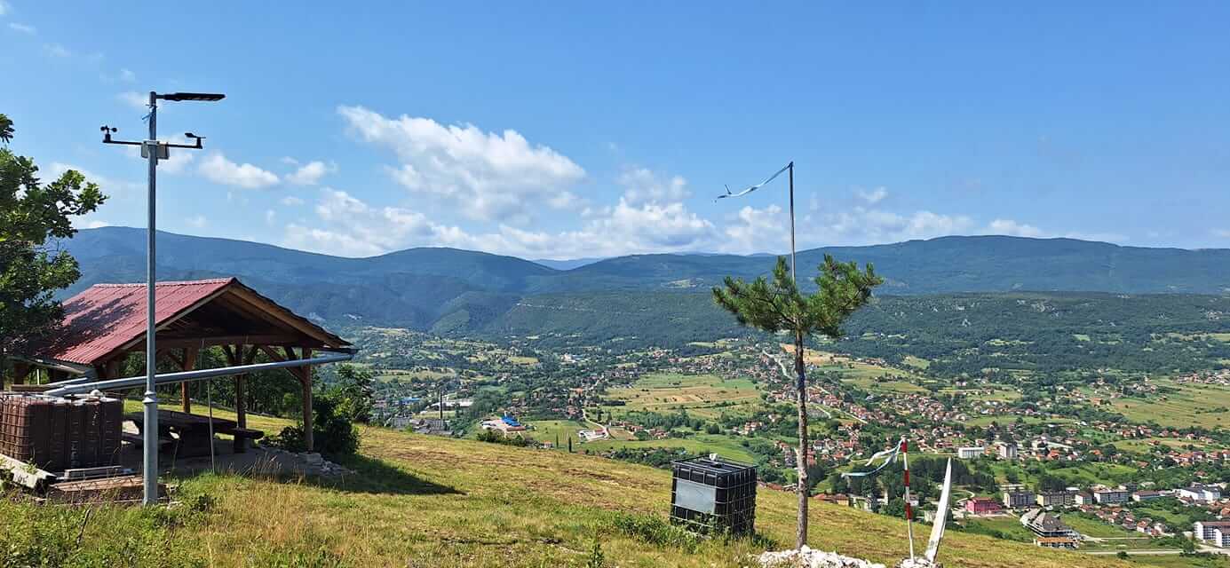
Weather Station at Takeoff
Kruškovac
Basic Information
The Kruškovac launch site above Drvar is one of the recognizable XC paragliding sites in the region. It is equipped with a paragliding hut, a shelter, and a spacious artificial turf surface on a well-maintained area. The site is suitable for all categories of pilots, tandem flights, and paragliding training.
Important Notices
The region is characterized by strong daytime thermal development and a potentially high cloud base, with rapid convective escalation during summer conditions. The Drvar valley is influenced by channelled valley winds, with possible wind shear effects at the valley–ridge transition.
U širem području BiH postoje zone sa mogućim zaostalim minsko-eksplozivnim sredstvima, te je obavezna provjera lokalnih informacija i kretanje isključivo po sigurnim pristupnim rutama.
Airspace
The launch site is located in Class G airspace. The paragliding zone may be subject to temporary activation due to military restrictions or helicopter operations. When conducting XC flights, caution must be taken to avoid entering controlled airspace. The wider area around Banja Luka is controlled by ABHANSA (AIS/NOTAM sistem). The launch site was built and is managed by Paraglajding klub Drvar, and the responsible person is Marko Zarač.
Location and Access
Access is possible by vehicle almost all the way to the launch site via an asphalt road, and partly via a 4 km gravel road. For transport and shuttle logistics, it is recommended to coordinate with the responsible person of the local club. Drvar is becoming a recognized destination for paragliding tourism, sports competitions, and club gatherings, and accommodation is available near the landing area.
Elevation
The launch site is located above the town at an altitude of approximately 675 m above sea level. The terrain is spacious, moderately sloped, and well maintained.
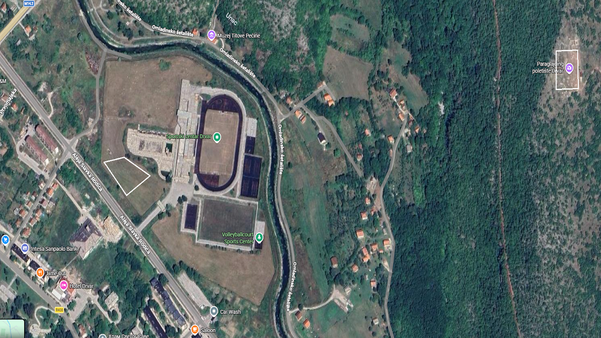
In good conditions, landing at the launch site is often performed. Landings are usually carried out at the official landing field near the stadium.
Launch and Landing Sites on the Map
- Takeoff: 44.379359, 16.396724
- Landing: 44.377749, 16.384846