Takeoff Balj
Weather Station at Takeoff
Balj
Basic Information
The Balj launch site is located on the mountain of the same name, near Andrijevica. The influence of mountain air currents provides favorable flying conditions over one of the most beautiful landscapes in Montenegro. The site attracts paragliding adventurers and cross-country pilots. There are southern and western launch areas on the mountain, expanding takeoff options for different weather conditions.
Important Notices
As this is a high-altitude launch site, weather forecasts and meteorological data on wind strength in the region should be taken into account.
Airspace
There are no specific airspace restrictions in the vicinity of the launch site.
Location and Access
Access to the launch site is possible only by off-road vehicles. From the main Berane – Andrijevica road, before reaching Andrijevica, turn left at the “Soko Štark” factory. From the turn-off, it takes approximately 20 minutes to reach the launch site by vehicle.
Elevation
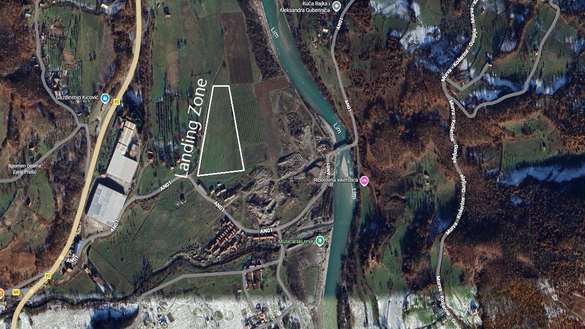
The launch site is located on a mountain at an altitude of 1,540 m above sea level. Pilots often fly cross-country and land in the valleys of nearby settlements. Landing is typically carried out on a spacious meadow between the Lim River and an industrial complex. The landing area is situated at an altitude of 730 m above sea level, offering more than 800 m of elevation difference.
Launch and Landing Sites on the Map
- Takeoff: 42.743036, 19.819818
- Landing: 42.744039, 19.789120